Sweden is 1,572 kilometres long from the southernmost tip at Smygehuk to the northern border above the Arctic Circle. A road trip from Malmö to Lapland covers more landscape change per kilometre than almost any other drive in Europe — from the beech forests and rape-seed fields of Skåne in the south, through the granite west coast, across the pine forests of the interior, up into the birch zone of Norrland and finally above the tree line on the fell roads of the Arctic. The same country, ten days, the full range.
This is a driving itinerary. You need a car. Sweden's motorway network is good and largely toll-free (the E6 has a small toll south of Gothenburg; budget 100 SEK). Petrol prices run approximately 17–19 SEK per litre in 2026. A medium car averaging 7L/100km across 2,000 kilometres uses roughly 140 litres — approximately 2,500 SEK in fuel.
The Route at a Glance
| Days | Leg | Distance | Overnight |
|---|---|---|---|
| 1–2 | Malmö → Österlen coast → Kristianstad | ~200 km | Österlen |
| 3 | Kristianstad → Gothenburg via E6 | ~280 km | Gothenburg |
| 4–5 | Bohuslän coast north from Gothenburg | ~200 km loop | Smögen/Grebbestad |
| 6 | Bohuslän → Dalarna (Lake Siljan) | ~380 km | Rättvik |
| 7 | Dalarna → Härjedalen/Jämtland | ~250 km | Östersund or Åre |
| 8–9 | Jämtland → Norrland → Kiruna/Abisko | ~600 km | Lycksele, then Kiruna |
| 10 | Kiruna → fly home (or train south) | — | Kiruna airport |
Start and end airports
Fly into Copenhagen (CPH) or Malmö (MMX) and drive north. Fly home from Kiruna (KRN) or Luleå (LLA) — one-way car hire is available from most companies and costs an additional drop-off fee of 800–1,500 SEK depending on the operator. Book this explicitly at the time of hire; not all companies allow one-way across such a long distance without advance arrangement.
Days 1–2: Skåne — Sweden's Garden
Malmö, Österlen coast, white sandy beaches
Cross the Øresund Bridge from Copenhagen (or fly directly to Malmö) and spend the first afternoon in Malmö itself — the Turning Torso on the waterfront, the old town grid around Stortorget, the Moderna Museet Malmö on the harbour. Malmö is a city of 350,000 with the compact energy of somewhere half the size; walk the Davidshallstorg neighbourhood in the afternoon and eat somewhere on Davidshallsgatan for dinner.
Day 2: drive east on road 9 toward Österlen — the southeastern corner of Skåne that produces Sweden's best food ingredients and has the flattest, most Mediterranean-feeling landscape in the country. The apple orchards around Kivik are in full blossom in May and heavy with fruit by August. Stop at Kåseberga on the coast — the Iron Age megalith site of Ales Stenar sits on a headland above the sea, 59 standing stones in the outline of a ship, free to visit, one of the most quietly impressive prehistoric sites in Scandinavia. Drive north along the coast through Simrishamn to Kristianstad for the night.
Day 3: Drive to Gothenburg
E6 north, Gothenburg arrival, Haga evening
A driving day. The E6 from Kristianstad to Gothenburg covers 280 kilometres in under three hours on good roads. Stop at Gränna on Lake Vättern if the timing works — a small town on a hillside above the lake, famous for polkagris (the red-and-white peppermint rock candy that has been made here since 1859) and for the view across the narrowest point of Vättern, which is so large it has its own micro-climate and storms.
Gothenburg for the night. Walk Haga in the evening, eat somewhere on the Vasastan strip, sleep well before two days on the coast.
Days 4–5: Bohuslän Coast
Marstrand, Smögen, Fjällbacka, granite swimming
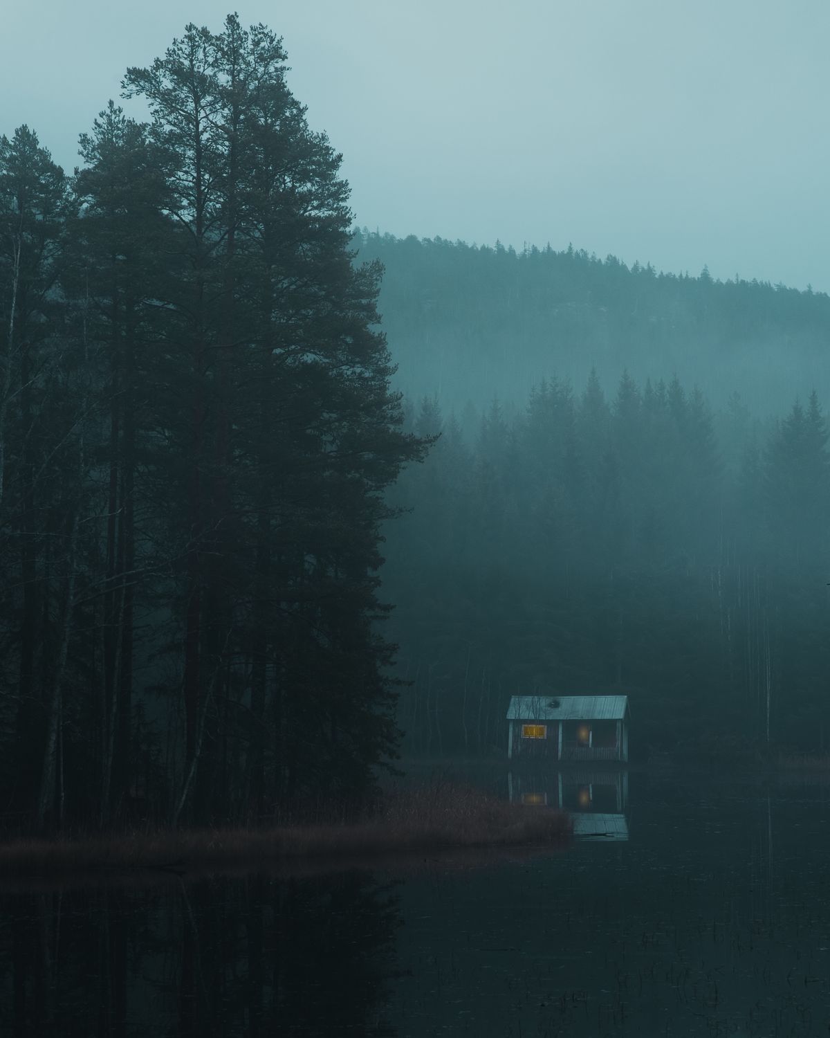
Day 4: drive north on the E6 and branch west onto road 161 toward Marstrand. The car-free fortress island, the flat granite rocks, the harbour lunch — see the 5-day Bohuslän itinerary for detail. Continue to Smögen in the afternoon for the boardwalk and the prawn boats. Night in Grebbestad or Lysekil.
Day 5: Fjällbacka in the morning (village walk, swimming rock below the cliff, Ingrid Bergman connection). Then take road 163 north through the coast villages — Hamburgsund, Fjällbacka, Tanumshede (where the Tanum Bronze Age rock carvings are a UNESCO World Heritage site, free to visit, 45 minutes). Continue to Strömstad for the optional Koster Islands ferry, or head directly northeast toward Dalarna.
Day 6: The Long Drive East — Bohuslän to Dalarna
380 km through pine forest to Lake Siljan
This is the longest driving day. From the north Bohuslän coast, take road 172 east to Trollhättan (the Göta Canal locks and waterfall are worth the 20-minute stop — the engineering is extraordinary and the café by the lock is good). Then E45 north through the Värmland forests to Karlstad, and road 26 east across to Borlänge and north to Rättvik on Lake Siljan.
The landscape changes markedly through this day. The open Bohuslän coast gives way to pine and birch forest that gets denser and darker as you move north and east. By the time you reach the Dalarna lake district, the forest is the same boreal landscape that covers most of northern Sweden — vast, quiet, occasionally dramatic where rivers or lakes break it.
Rättvik by early evening. Swim off the dock (628 metres into the lake — the longest in Sweden), eat at one of the harbourside restaurants, sleep. The lake at dusk in July is worth the long drive to get there.
Day 7: Dalarna to Jämtland
Mora, Nusnäs, then north toward the mountains
Morning in Mora — the town at the northern end of Lake Siljan where the Vasaloppet cross-country ski race ends every March. The Nusnäs workshop 3km east is where Nils Olsson produces the authentic Dalarna horses by hand (free to watch, direct sales at lower prices than Stockholm shops). The Vasaloppet museum documents the race with surprising depth (100 SEK).
Drive north on E45 — the main road through central Sweden that runs almost the entire length of the country. The landscape becomes noticeably wilder above Mora: the farms thin out, the forests deepen, the rivers become faster and darker. Östersund by early evening — a small city on the shores of Lake Storsjön, where the Swedish version of the Loch Ness monster (Storsjöodjuret) was allegedly sighted repeatedly from the 1600s onward. The old town and the Frösön island connected by bridge are worth an evening walk. Alternatively, continue 90km west to Åre for the mountain atmosphere and the village infrastructure.
Days 8–9: Norrland and Lapland
E45 north through Arctic Sweden to Kiruna and Abisko
Day 8: the E45 continues north from Östersund through Norrland — Strömsund, Vilhelmina, Sorsele, Arvidsjaur. This is the longest unbroken stretch of forest in Europe: hours of spruce and pine with occasional river crossings, reindeer on or near the road (slow down; they are entirely unimpressed by cars), and the light changing as you move further from the 60th parallel. Stop at Lycksele for the night — a reasonable-sized town with a riverside location and an animal park (Lycksele Djurpark) that keeps northern Swedish wildlife at close range.
Day 9: continue north on E45 to Gällivare, then road 98 west to Kiruna — the iron ore mining town above the Arctic Circle whose entire centre was relocated 3km east between 2020 and 2025 because the mine was undermining the original buildings. The new town centre is architecturally interesting for what it is: an entire Swedish municipality transplanted. From Kiruna, road 98 continues 90km west to Abisko — the small mountain station on Lake Torneträsk that sits in its unique cloudless microclimate below the Scandinavian mountain chain. Camp or stay at the tourist station. In summer, the midnight sun sets around 11pm and rises by 1am — barely dark.
Day 10: Kiruna and Departure
Abisko morning, drive to Kiruna, fly south
Morning at Abisko — the short Royal Trail section (Kungsleden) from the tourist station along the south shore of Torneträsk is walkable in 2 hours and gives the mountain landscape without requiring the full multi-day Kungsleden trek. The view across the lake to the Norwegian mountains is the one photograph most people take home from this trip.
Drive back to Kiruna (90km, 1 hour). Return the hire car at Kiruna airport. Flights from Kiruna to Stockholm (1.5 hours) connect to European hubs. Alternatively, the overnight train from Kiruna to Stockholm (16 hours, arrives next morning) is a good way to close the loop — you sleep through the same landscape you drove north through, in the opposite direction, and arrive back in the capital.
What It Costs
Car hire for 10 days: 5,500–7,500 SEK depending on company, car size and booking timing. Petrol (~2,000km at 7L/100km): approximately 2,400 SEK. One-way drop-off fee (if flying home from Kiruna): 800–1,500 SEK. Accommodation (10 nights, mid-range): 8,000–14,000 SEK. Food: 3,000–5,000 SEK. Activities and entrance fees: 1,000–2,000 SEK. Total per person (excluding flights): approximately 20,000–32,000 SEK (€1,750–2,830).
Practical Notes
Speed limits: 110 km/h on motorways, 90 km/h on main roads, 70 km/h on smaller roads. Speed cameras are common and fines are substantial. Allow the GPS times to be accurate rather than optimistic.
Reindeer on roads: Above approximately 63°N, reindeer are a genuine hazard. They appear suddenly, stand still in headlights, and travel in groups — where there is one, there are usually more nearby. Drive accordingly in forest sections.
Petrol stations: Above Arvidsjaur, petrol stations are less frequent. Fill up when the tank reaches half rather than when it reaches empty. The Mäcken and Preem chains cover the main E45 route well.
Wild camping: Under Allemansrätten, you can pitch a tent anywhere in Sweden's natural landscape for up to two consecutive nights. For a road trip, this significantly reduces accommodation costs on the northern legs where hotels are sparse and expensive.